
Wayfinding Mobile Apps Improve Patient Experience at 2 Large, Complex Facilities
Robert Wood Johnson University Hospital and the National Institutes of Health adopt Connexient’s wayfinding solution for patient and employee apps.
// By Jane Weber Brubaker //
“Would you tell me which way I ought to go from here?” asked Alice of the Cheshire Cat. “That depends a good deal on where you want to get to,” replied the Cat. —Alice in Wonderland
How did we survive before GPS? The days of getting lost, ordering AAA maps, and having to stop and ask directions are numbered as global positioning systems reliably steer us to our destinations—as long as we are in our cars, that is, or outdoors. But indoor locations can be just as challenging to navigate, especially very large venues like Robert Wood Johnson University Hospital (RWJUH) in New Brunswick, New Jersey and the National Institutes of Health (NIH) Clinical Center in Bethesda, Maryland.
Both organizations turned to indoor mapping and location-based services provider Connexient for help, with the goal of making it easier for patients visiting these facilities to find their way around. “Our mission is to solve this pain point of patient experience that an awful lot of people get lost and it is very frustrating,” says Geoff Halstead, Chief Product Officer at Connexient.
Find Your Way with RWJUH’s Turn-by-Turn Navigation App
On July 29, Robert Wood Johnson University Hospital announced the launch of MediNav™ Navigator Edition 2.0, Connexient’s healthcare solution, stating that it was “the first hospital in North America to deliver for its patients, visitors, and staff the world’s first true turn-by-turn indoor navigation smartphone application.” The app, RWJUH Find Your Way, is available in the iTunes and Google Play stores.
“We are a very large campus,” says Joanne Arico, RN, BSN, Director of Patient Experience at RWJUH. “We take up several city blocks.” She describes a labyrinth of buildings, hallways, bridges, parking garages, and several information desks where patients check in. Peter Haigney, Director of Public Relations, adds to the list some of the major facilities connected to the main hospital—Rutgers Robert Wood Johnson Medical School, Rutgers Cancer Institute of New Jersey, Children’s Specialized Hospital, Bristol-Myers Squibb Children’s Hospital.
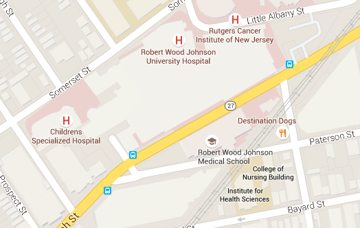
Map of RWJUH (Click to enlarge.)
Culture of Kindness the Driving Force
“We noticed we had a lot of patients that were in one building that needed to be in another building,” says Arico. In keeping with the organization’s “culture of kindness,” staff were trained to escort lost patients to the right location rather than giving them detailed directions like—go down the hall, go down the steps, don’t take the first set of elevators, take the next set, and when you get to your floor, take a left—and sending them on their way. “Usually people are here because of a life-changing event and more often than not it is not a positive life-changing event, so it is a very stressful situation,” says Haigney. “Anything we can do to make that situation easier, as we get them towards a positive outcome is a major plus.”
How It Works
Bluetooth beacons placed throughout the facility enable the technology. Two hundred of them are in place, and they enable indoor positioning with 1- to 2-meter accuracy. “They are probably no bigger than a doorbell,” says Arico.
Once visitors download the app, a blue dot shows them where they are and provides turn-by-turn directions. “I wanted it to be exactly like when I’m driving in my car,” says Arico. “It doesn’t have the voice piece, but it does have those turns, and the blue dot moves with you.”
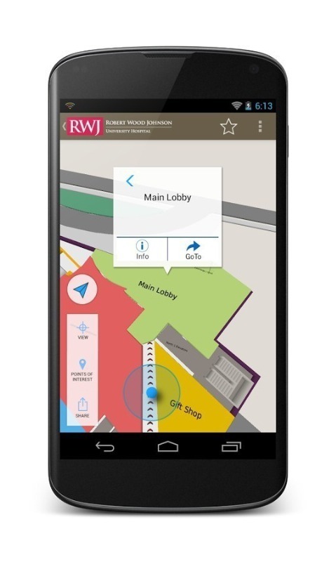
RWJUH App Includes Indoor Positioning with 1-2 meter accuracy (Click to Enlarge.)
If patients do not have iPhone or Android devices, there are kiosks with stationary iPads in each of the reception areas where visitors can key in their destination and print a map.
Refining the Details Prior to Launch
RWJUH invited volunteers and staff to beta-test the technology prior to release, and based on feedback, made refinements. One priority was getting the correct names of locations into the system based on how staff referred to them. “Three-North is our CCU,” says Arico, giving an example. “We had to work with our reception services to find out if they were telling people to go to CCU or Three-North.” When testers suggested that the app colors were too strong, they softened them. Menu items were rearranged.
Promoting the App
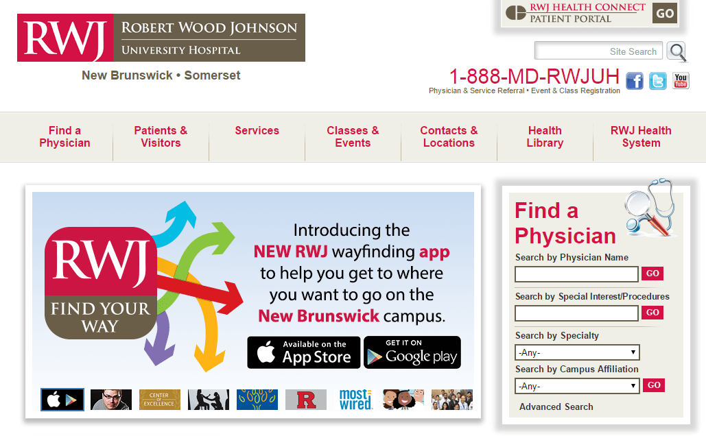
Now that the app is live, Robert Wood Johnson is actively promoting it to patients and visitors. The first image on its homepage carousel features the Find Your Way App.
A video on the website demonstrates the experience for patients and visitors.
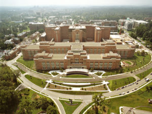
NIH’s Challenge: 3.5 Million Square Feet Under One Roof
The vast complex that houses the National Institutes of Health (NIH) spans 322 acres and can be challenging for both patients and staff to navigate. “We have three and a half million square feet under one roof, so it’s understandable where a patient could get turned around here,” says Eric Cole, Chief Administrative Officer at NIH Clinical Center.
National Institutes of Health
NIH Clinical Center is implementing Connexient’s MediNav™ indoor mapping and location-based solution. “We expect by the end of the summer that we’ll be in beta testing,” Cole says. The native app will be available through the iTunes and Google Play app stores.
Parking Assistance, Integration with Points of Interest
At NIH Clinical Center, more than 650 beacons will be installed to guide patients through nine miles of corridors, according to Halstead. The NIH version of the app will also help visitors keep track of where they parked and get back to their cars. “They can go about their visit, and assuming they are not staying here overnight, at the end of the visit, they can say, ‘Take me back to the car,’” Cole says. It will also connect visitors with points of interest within the building, such as ATM machines, restrooms, and dining facilities, as well as venues in the surrounding area, including local hotels and locations such as the Metro station and on-campus shuttle.
Proximity-Based Alerts, Bilingual Versions of App
Other planned features include proximity-based alerts. Walking by the pharmacy, patients could receive an alert reminding them to pick up their medications. If they are near the blood bank, they might receive an alert to donate blood.
The app will be available in both English and Spanish, the two predominant languages spoken by patients and visitors. “We felt it was important to have it in both of those languages from the get-go,” says Cole. Summing up the overarching vision for the consumer app, he notes, “However they want to interact with us is how we want to interact with them.”
Staff Version Integrates with Employee Directory
NIH plans to add a staff component to the app as well. “There’s a staff directory so people who work here can look up an individual and contact them by phone or email, or can tell the application, ‘Take me to their office,’ and it will take them to that location based on what we have in our employee database,” says Cole. The app will integrate with Google Maps for directions between NIH’s 75 buildings and will include information specifically for staff. “We’ll be able to grab things like bike rack [locations] and things like that that staff would be able to use,” he says.
NIH Vision: Everything in the Palm of Your Hand
Cole’s vision is to centralize all relevant information within the app. “From the patient experience, they [will] have everything they need right there in the palm of their hand,” he says. Halstead’s view is that the location-based services are the starting point for clients. “Our vision is the concept of location enabling enterprise IT. You can start to create multiple streams of benefit,” he says.
Patients Are Partners in Research at NIH
Cole stresses that the primary goal is to improve patient experience and ensure that patients and visitors can navigate the building efficiently and safely. All patients at NIH Clinical Center are there to participate in a clinical trial. “We are the nation’s largest clinical research hospital that’s owned by the American people,” he says. “We feel it’s extremely important to get this right the first time, for our patients. They are our partners in research. We couldn’t do what we do without them.”
Typical Facility Size
The threshold in terms of size where Connexient’s solution makes sense is 500,000 square feet. The typical deployment is one million to one-and-a-half million square feet. There are three components to the model:
- Implementation, priced on a per-square-foot basis
- Licensing of the software (typically three- to five-year contracts)
- Technical support and/or mapping as a service
Jane Weber Brubaker is Editor of eHealthcare Strategy & Trends.
Related Articles:
Wayfinding App Helps Visitors and Staff at University Health System Find Their Way
Robert Wood Johnson University Hospital Goes Native with Mobile Apps
Healthcare System Develops Hub to Congregate Its Mobile Apps
MyDigitalLife: App-Happy Patients and Providers Are Going Mobile—Are You Ready?